■You can sketch the Iki/Ashibe slanted tunnel entrance Precise surveying has been completed and the tunnel opening is now visible.
Over two days, May 4th and 5th, precision surveying was carried out in preparation for the construction of the Ashibe slope shaft in Iki. From the data from the previous two times, the location of the mine entrance and the direction in which the tunnel will extend were determined. In response to this, we conducted a survey with the aim of drawing a three-dimensional sketch by collecting data in the perpendicular direction at points every 50 meters in the extension direction. With this, construction can finally begin, and we will move forward with a series of programs starting with the groundbreaking ceremony.
Last time, we found the site's inclined shaft entrance point by carving from the two "third-class triangulation points" and named it "No. 16" point. This is the tunnel entrance, and is the starting point for the working tunnel, which runs in an ``east-northeast'' direction at a slope of 1/4. This time, we surveyed the site from the third "triangulation point" to confirm accuracy and precision. Although this is a ``fourth-order triangulation point'', it was located at an altitude of 50 meters and the site could be seen in one shot, so we obtained reinforcement data and were able to obtain necessary data such as latitude, longitude, distance, and angle.
Furthermore, data was collected by surveying at right angles every 50 meters from this "No. 16" point. This made it possible to draw a rough sketch from the mine entrance to the extension direction. The data will be scrutinized and accurate drawings will be created soon.
The site's topography is a four-tiered field that quickly descends to the sea to the east, and is expected to be packed with facilities such as a mine entrance, material storage area, site office, warehouse, and parking lot. In addition, the distance from the seabed when out to sea, or ``soil cover,'' is 15 meters, which provides plenty of leeway. From now on, the schedule for the start of construction will be determined depending on how the construction costs are raised.
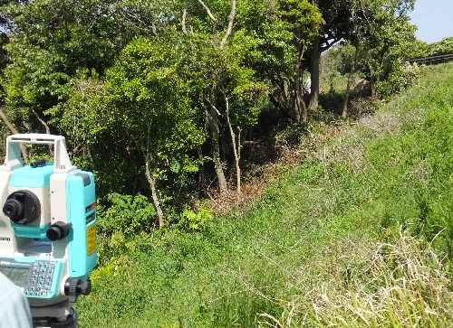
[Photo] Point "NO.16", the starting point of the mine entrance, altitude 24m, the figure visible in the gap between the trees on the right side of the front is the direction of extension.
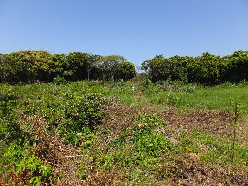
[Photo] Extending direction from the 50m point ahead of “NO.16” The red flag in front is the 100m point
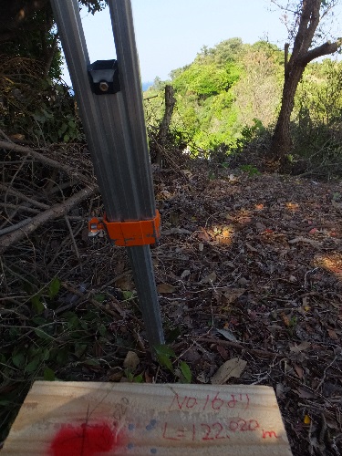
[Photo] From the 122m point ahead of "NO.16", in the direction of extension, the cliff on the east coast goes straight down in front of you.
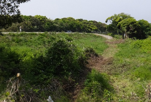
[Photo] Looking towards "NO.16" and the mine entrance from the 100m point. The prefectural road runs east-west at the top.
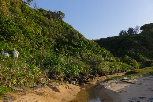
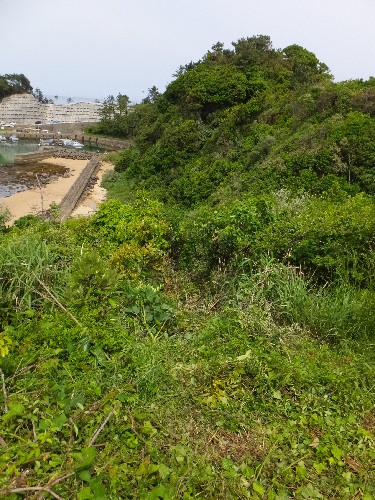
[Photo] Viewing the survey status from the coast. The "122m" point is on the upper right. A tunnel runs 15m underground.

![]()