■Second survey for installation of Iki/Ashibe inclined shaft entrance Extended route to “east-northeast”
In preparation for the construction of the Ashibe inclined shaft in Iki, the location and extension direction of the shaft entrance must first be determined. The first survey was carried out in August last year, and at that time there were concerns about the short distance to the sea. The extension route was set to be ``north-northeast,'' but it was considered that it would pass through more land, and the survey was conducted again this time.
As a result, the extension route will be ``east-northeast,'' running between the prefectural highway and the coastline. This is based on the premise of a tunnel connecting to Tsushima, and will be used to drain water that comes out there. Construction of the wellhead is expected to begin next year.
The survey was carried out over two days, March 18th and 19th. They identified a ``triangulation point'' (reference point) near the planned mine entrance, measured the distance from there, and determined the mine entrance. One of the triangulation points is at the tip of the Yawata Peninsula, where Sakyohana, a scenic spot and tourist destination, is located. Surveys were carried out at 16 locations, including a ``crossing survey'' that involved surveying from there to the prefectural road that passes in front of the mine entrance site.
This peninsula on the east coast has become a tourist spot because the strangely shaped rocks and cliffs that jut out from the sea create a unique scenery, and the surrounding sea is home to sea urchin, a specialty of Iki. Iki Island is shaped like an upside down plate. Although the wind is calmer than that of Tsushima, the ``island of the wind,'' the sound of birds singing amidst the wind and spring haze makes the sound of hammering for the construction of the Japan-Korea tunnel grow louder.
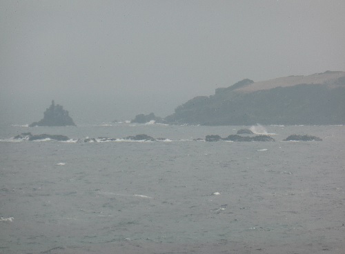
[Photo] "Tokai survey" measuring a distance of 1,700m across the sea from the prefectural road to the Yawata Peninsula/Sakyohana area
The tip of the Yawata Peninsula and Sakyohana It is said to be one of the eight pillars in the myth of the birth of Iki Island, the ``oribashira''.
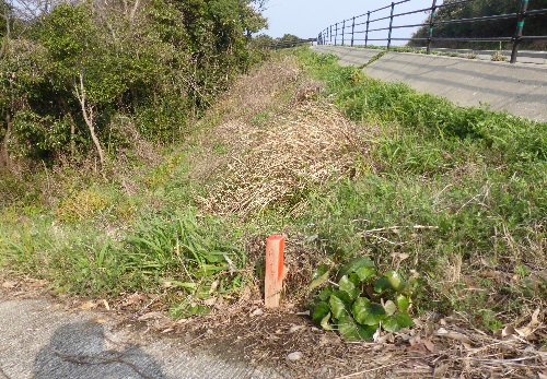
[Photo] A new starting point for a new route that follows the prefectural road from the mine entrance.
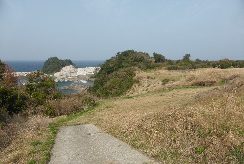
[Photo] Boat mooring near the mine entrance The east-northeast route runs between the prefectural road and the coastline

![]()